The Two Declining Sundials of Grimsthorpe Castle
Grimsthorpe Castle is a lovely country house in Lincolnshire, some four miles north-west of Bourne on the A151. It lies within a 3,000 acre (12 km²) park of rolling pastures, lakes, and woodland landscaped by Capability Brown. While Grimsthorpe is not a castle in the strict sense of the word, it certainly looks like one! Today the House is owned through a trust by the granddaughter of Lady Astor, Jane Heathcote-Drummond-Willoughby, 28th Baroness Willoughby de Eresby. It is open for certain periods of the year to visitors under the Historic Houses Association Scheme.
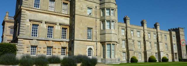
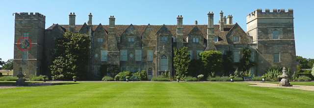
The present appearance of the house is the work of Sir John Vanbrugh. It was his last major work and indeed he died before it was finished. The works involved extending and refronting the house dating from the 13th century and which survives behind and around a Tudor quadrangle. The building is listed for its special architectural or historic interest by Historic England as GRIMSTHORPE CASTLE AND NORTH COURT. List Number: 1062823. The listing details recorded by Historic England only appear to record one of the two sundials that are on either side of the SW corner of the House.
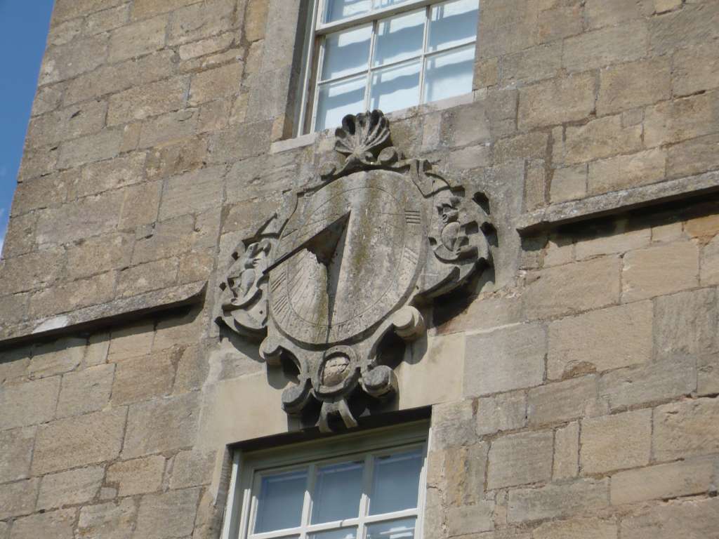
The two sundials are circled in red in the top two images. A simple octagonal SW declining dial is mounted on the 'Western' side of the House and an elaborate SE Declining dial in a cartouche is situated on the 'Southern' side of the House. The dial in the cartouche is dated 1757.
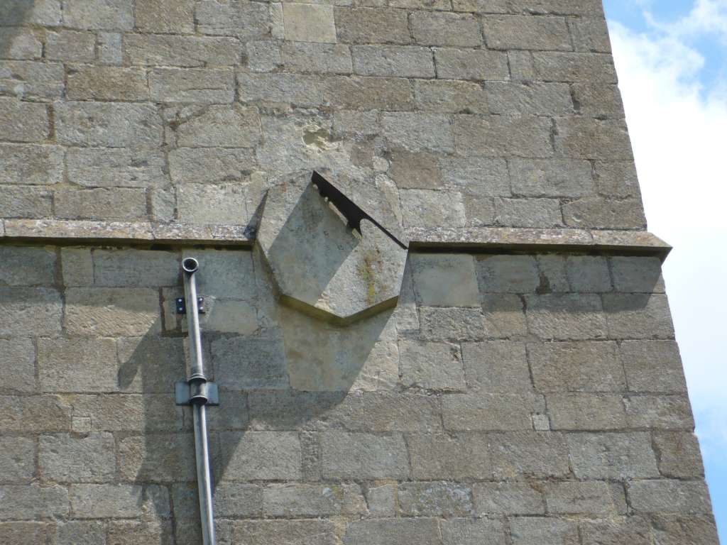
 The simple,
octagonal, great-decliner dial although complete with its gnomon, is no longer marked with any
discernible time scale. There are few signs of erosion of the stone so
originally the dialplate may well have been painted at one time rather than engraved.
It is somewhat smaller than the more elaborate one on the Southerly wall.
That dial though, is also in good condition and is engraved. Only some lines and numerals under the
gnomon show signs of drip erosion from rain.
The simple,
octagonal, great-decliner dial although complete with its gnomon, is no longer marked with any
discernible time scale. There are few signs of erosion of the stone so
originally the dialplate may well have been painted at one time rather than engraved.
It is somewhat smaller than the more elaborate one on the Southerly wall.
That dial though, is also in good condition and is engraved. Only some lines and numerals under the
gnomon show signs of drip erosion from rain.
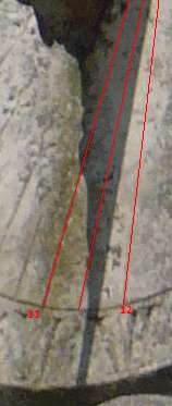
These dials of course show Local Solar Time. It is interesting to estimate the accuracy of any well made dial by noting the time that a (digital) photograph was taken and estimating the solar time that these dials should have shown at that time by taking account of BST, the longitude of the dial and the equation of time.
The dial is located at 52.792038N, 0.452545W. The image of the larger dial was taken at 12:50 pm BST on 15 July 2008. The correction for solar time that applied on that date and at that location is such that the sundial was approx 1 hr 7m 49secs slow on BST. So, provided the clock in the camera was correctly set, this suggests that the dial in the photograph should be reading a solar time of 11:43:24 am.
Overlaying red lines on the hour and half hour lines allows us to see that the indicated solar time is remarkably accurate. Probably correct to within a minute - and that might easily be the error in the clock on the day.
Not bad for a (then) 250 year old time piece that has been outside all the time and in all weathers...
There is more about the Castle at http://www.grimsthorpe.co.uk/about-us/the-castle/ . The Historic England Listing Entry Details can be found at https://historicengland.org.uk/listing/the-list/list-entry/1062823
10/08/2017 Upper two and lower left dial images courtesy Wikipedia Creative Common Licence, All others© Patrick Powers 2008.